
Your Ultimate Road Trip Guide to Explore Arches, Canyonlands, Capitol Reef, Bryce Canyon, and Zion
Ready for your next outdoor escape? Utah's got you covered! Whether you're a hiking pro or just someone who loves soaking in the beauty of nature, Utah's got something for everyone.
Come along on my latest Utah road trip as I explore the Mighty 5 National Parks: Arches, Canyonlands, Capitol Reef, Bryce Canyon, and Zion. Get ready to discover the enchantment of each park and dive into Utah's stunning landscapes on this whirlwind adventure!

Post Navigation:
Devil’s Garden - Hike
Delicate Arch - Hike
Window Section
Mesa Arch
Grand View Point Overlook and Trail
Hickman Bridge - Hike
The Grand Wash - Hike
Pies at Gifford House
Sunset Point
The Rim Trail - Hike
Navajo/Queen Loop - Hike
Scenic drive from Bryce to Zion
Angels Landing - Hike
The Narrows - Hike
Springdale
Arches National Park
Nestled in southeastern Utah, just outside Moab, this captivating park is renowned for its striking red rock formations, towering sandstone arches, and breathtaking vistas. With its iconic features and unique landscape, Arches National Park offers a one-of-a-kind experience found nowhere else on Earth. Whether you're up for a hike, eager to snap some photos, or simply looking to soak in the scenery, Arches National Park is the ultimate playground for outdoor enthusiasts of all kinds.


Devil's Garden Hike
Devil's Garden Hike is a 7.8-mile loop trail (including spurs) located at the far end of the park road, about a 45-minute drive north from the Visitor Center. This trail is the longest in the park and offers a mix of features like arches, spires, and narrow rock walls called "fins."

If you're up for a shorter trek, consider stopping at the first viewpoint of the Landscape Arch, just a 1.9-mile round trip. But if you're eager for more, continue your exploration along the trail to soak in additional arches and breathtaking views. One of the viewpoints I particularly enjoyed was Partition Arch, an optional stop along the main path that I highly recommend checking out!


After reaching Double O Arch, you can go back the way you came or take the Primitive Trail to return to Landscape Arch. The Primitive Trail is tougher with more rocks to climb and a trickier path to navigate. But going in a loop lets you see new things, making your trip even better.
Note: Due to its popularity, arrive early as parking can fill up fast
Length: 7.8 mile loop trail (including spurs)
Time: 3-4 hours for the entire trail
Difficulty: Moderate to strenuous, depending on your route


Delicate Arch Hike
Delicate Arch is a must-see when exploring Arches National Park. Amongst its 2,000+ stone arches, this one stands out as a symbol of Utah (it's even on Utah license plates) and one of the world's most famous geological wonders.

To reach Delicate Arch, you'll tackle a steep climb over slick rock, with little shade and some exposure to heights. Just before you reach the arch, you'll navigate a narrow rock ledge. As you round the final corner of the trail, the grand arch will emerge before you, perched on a high red rock slope.
Note: Avoid this hike during the scorching midday summer heat due to the lack of shade. Instead, consider experiencing it at sunset for optimal photographic lighting!
Length: 3.2-mile out-and-back trail
Time: Typically 2-3 hours (though we made it to the arch in just 45 minutes)
Difficulty: Moderate


Window Section
The Windows Section boasts numerous arches, standing out as one of the park's most scenic areas. Here, you'll encounter captivating sights like North Window, Turret Arch, and Double Arch. Since you might be tired from hiking, a stop at the Windows Section is ideal because it doesn't require much additional walking. In fact, one arch is easily visible from the parking lot!
Length: 1-mile round trip
Time: 30-60 min
Difficulty: Easy


Canyonlands National Park
Just a 30-minute drive from Arches lies the next gem, Canyonlands National Park, beckoning for exploration. This park is renowned for its striking desert scenery, sculpted by the mighty Colorado River. The Island in the Sky district stands out as the most convenient to reach, close to Moab, a major city, and offering a picturesque drive that treats visitors to breathtaking panoramic views.

Mesa Arch
Mesa Arch looks its best at sunrise when the morning light shines through, turning the arch red. You won't be alone – many photographers gather there to capture this stunning scene. These are some of my favorite photos from our trip!

Grand View Point Overlook and Trail
The Grand View Point Trail, located at the southernmost end of the Island in the Sky scenic drive, offers an easy hike with stunning vistas all along the way, making it a worthwhile stop. When you reach the end of the trail, you can take a seat and soak in the magnificent panoramic view of vast canyons and distant mountains.
Length:1.8 miles round trip
Time: 1 hour
Difficulty: Easy


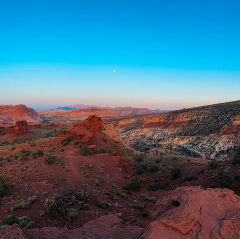
Capitol Reef National Park
Capitol Reef National Park often flies under the radar compared to other national parks, yet it offers a serene escape from crowds and showcases breathtaking landscapes and remarkable geology. True to its name, the park's multicolored mesas, buttes, and vibrant desert vistas resemble a coral reef. Conveniently located between Arches and Bryce Canyon parks, we stopped for a night to enjoy the peaceful beauty of Capitol Reef along the way.

Hickman Bridge - Hike
The Hickman Bridge trail provides hikers with a scenic journey to a magnificent natural arch. While the trail isn't lengthy or overly steep, the steepest section is at the start as it ascends the mountainside. You can complete a small loop through the bridge, allowing you to pass beneath it and circle back around the mountain to rejoin the trail.
Length: 2 miles round trip Time: 1 hour
Difficulty: Easy to moderate


The Grand Wash - Hike
Looking for a simple hike? Try The Grand Wash trail. It's mostly flat, leading you along a dry riverbed at the canyon's base. After about a mile, you'll reach the Narrows, with steep canyon walls on each side. While narrow enough for a car, it still gives you that canyon vibe. You don't have to hike to the end; just go as far as you want and then turn back.
Length: 2.3 miles one way, but hike as far as you’d like
Time: 1-2 hours
Difficulty: Easy


Pies at Gifford House
One of the highlights (or 'pielights') of Capitol Reef is the pies! Stop by at the Gifford House for your pick of handmade pie. Choose from classics like Apple, Strawberry Rhubarb, Cherry, Peach, and Mixed Berry. Don't forget to grab a cup of ice cream for the perfect pairing. These pies taste even more heavenly after a day of hiking!
Note: The Gifford House is open daily until November from 9:00am to 4:30pm, with a 45-minute closure from noon to 12:45pm each day. The midday closure can be inconvenient, so plan your visit accordingly to avoid waiting!


Sunset Point
Capitol Reef has an incredible location for sunset gazing, fittingly named Sunset Point. Accessible via a brief and straightforward hike of just a third of a mile. The hike takes 10-15 minutes and starts from a rough dirt road. Be sure to allow enough time to drive and hike to the viewing point before the sun sets.


Bryce Canyon National Park
Bryce Canyon National Park stands out for its unique features. Rather than a single canyon, it comprises several natural amphitheaters carved into a high plateau. Among these, the most renowned is the Bryce Amphitheater, characterized by its irregularly eroded rock formations known as hoodoos.
The park offers numerous hiking trails and scenic viewpoints accessible by car. You can comfortably explore and enjoy Bryce Canyon in just one day before heading to your next destination, Zion.

The Rim Trail - Sunset Point to Sunrise Point
The Rim Trail from Sunset Point to Sunrise Point follows the rim of the breathtaking Bryce Canyon Amphitheater, offering stunning views of the hoodoos below. This particular stretch of the Rim Trail is the only paved section and provides the simplest stroll in the park.
Length: 1-mile round trip, half-mile one-way
Time: 30-60 minutes
Difficulty: Easy


Navajo/Queen loop
The Navajo/Queen trail combo steals the show as the park's top hike, and it's no wonder why! It's the go-to trail for newcomers seeking a moderate trek into the Bryce Canyon Amphitheater, where they can wander among the mesmerizing hoodoos.
The Queen's/Navajo Combination Loop merges the expansive vistas and distinct hoodoos of the Queen's Garden Trail with the renowned switchbacks and towering canyon walls of the Navajo Loop Trail.
Length: 3-mile loop
Time: 1.5 hours
Difficulty: Moderate


Zion National Park
Located in the southwestern corner of Utah, near the Nevada and Arizona borders, Zion National Park stands as Utah’s first national park. It's a popular summer destination for families and adventurers, offering hiking, camping, backpacking, climbing, and more. Zion features a variety of landscapes, including deserts and high-altitude forests, spread across its stunning canyons and plateaus.
Scenic drive from Bryce to Zion
When driving from Bryce Canyon (coming from the east), don't miss the picturesque Hwy 9, the main road leading to Zion National Park. This route showcases many famous Zion landmarks, including Zion Canyon and the park's mile-long tunnel, as well as the scenic Checkerboard Mesa area.
This 26-mile road winds through some of the most stunning terrain globally, heading eastward. Since it passes through Zion National Park, there's a $30 park entrance fee required (unless you have a national park pass, see my tips below), but it's definitely worth the investment for the breathtaking views.


Angels Landing - Hike
The best part of our Utah adventure was the Angels Landing hike. What made it even more memorable was our unplanned adventure. Initially, we hadn't intended to embark on this trail, having missed out on the permit when we applied months prior to our trip. However, luck was on our side when we participated in the day-before lottery and snagged the much-coveted hiking permit! Maybe you'll score like we did, so definitely give it a shot the day before!


Why the emphasis on permits? Well, this trail is carefully managed to avoid overcrowding due to its challenging sections involving rock scrambling and climbing. Fortunately, fixed chains along the rocky cliffs help navigating these thrilling segments. However, it's worth noting that if heights unsettle you, this may not be the trail for you.
While anyone can hike up to Scout's Lookout, the most exhilarating part of the journey—the Angels Landing section—requires a permit, which will be verified by a ranger. And let me tell you, the ascent to Scout's Lookout isn't a walk in the park either. You'll have to conquer a series of 21 switchbacks known as Walter's Wiggles.
Length: 5.4 miles round-trip, from the trailhead to the summit and back
Time: 4-5 hours
Difficulty: Strenuous


The Narrows - Hike
The Narrows, the narrowest part of Zion Canyon, is one of the park's most popular spots. You can reach The Narrows by strolling along the paved, wheelchair-friendly Riverside Walk for one mile from the Temple of Sinawava, the final shuttle stop.

If you're up for more, you'll be walking in the Virgin River. This could mean wading upstream for just a few minutes or embarking on an all-day trek. To prepare, we rented waterproof gear the night before from one of the many rental places in Springdale, the town outside Zion. We ended up hiking 2.5 miles one way, totaling 5 miles, and felt pretty sore and tired afterward! Yet, it was worth the effort, as it was the most unique hike I've experienced so far!
Note: You'll need to rent the right gear—waterproof shoes, pants or waders, and a walking stick
Length & Time: It is possible to hike the strenuous ten-mile round trip to Big Spring, a full-day adventure. Or, simply hike as far as you want.
Difficulty: Very strenuous


Springdale
Discover Springdale, a charming town nestled on the southern edge of Zion, welcoming travelers from the Park. Set against the backdrop of Southern Utah's towering red, white, and pink-striped cliffs, it offers stunning views right from its main street. With a variety of amenities including restaurants, shops, and galleries, Springdale has everything you need.


General Tips
Thinking of recreating this road trip? I recommend starting in Salt Lake City and finishing up in Las Vegas, where you can catch your flight home. Renting a car for a one-way trip is an excellent choice to cover this extensive ground. Also, you can do the trip in reverse!
Where to Stay: Break up your driving time by booking accommodations in three key spots: Moab (for Arches and Canyonlands), Torrey (for Capitol Reef), and Springdale (for Zion).
Book Early: Secure your accommodations well in advance to avoid high prices during peak seasons. For instance, when we searched for hotels in Springdale, only premium rooms were available. In such cases, consider AirBnB for better value.
Hike Early: Beat the crowds and heat by hitting the trails early, particularly important for popular trailheads and Zion shuttles.
Hiking Essentials: Don't forget your hiking must-haves - sturdy shoes, moleskin for blisters, water bottle, sun hat, and sunscreen.
National Park Pass: Consider investing in a National Park Pass for convenient access to multiple parks. For $80, it covers the entrance fee for your entire car.
Thanks for reading!
- The Maine Chick


Comments